


BARNETT Voting District, De Witt County, Illinois
About
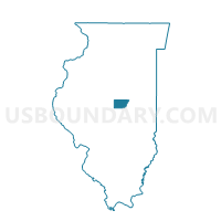
Outline

Summary
| Unique Area Identifier | 569988 |
| Name | BARNETT Voting District |
| County | De Witt County |
| State | Illinois |
| Area (square miles) | 37.40 |
| Land Area (square miles) | 37.39 |
| Water Area (square miles) | 0.01 |
| % of Land Area | 99.97 |
| % of Water Area | 0.03 |
| Latitude of the Internal Point | 40.17449870 |
| Longtitude of the Internal Point | -89.09697860 |
Maps


Graphs
Select a template below for downloading or customizing gragh for BARNETT Voting District, De Witt County, Illinois


Neighbors
Neighoring Voting District (by Name) Neighboring Voting District on the Map
- AETNA Voting District, Logan County, IL
- ATLANTA 3 Voting District, Logan County, IL
- CLINTONIA 4 Voting District, De Witt County, IL
- CLINTONIA 5 Voting District, De Witt County, IL
- ORAN Voting District, Logan County, IL
- TEXAS Voting District, De Witt County, IL
- TUNBRIDGE Voting District, De Witt County, IL
- WAPELLA Voting District, De Witt County, IL
- WAYNESVILLE Voting District, De Witt County, IL
Top 10 Neighboring County Subdivision (by Population) Neighboring County Subdivision on the Map
- Clintonia township, De Witt County, IL (7,832)
- Atlanta township, Logan County, IL (1,926)
- Texas township, De Witt County, IL (1,246)
- Wapella township, De Witt County, IL (944)
- Tunbridge township, De Witt County, IL (760)
- Waynesville township, De Witt County, IL (713)
- Aetna township, Logan County, IL (535)
- Barnett township, De Witt County, IL (406)
- Oran township, Logan County, IL (378)
Top 10 Neighboring Elementary School District (by Population) Neighboring Elementary School District on the Map
Top 10 Neighboring Secondary School District (by Population) Neighboring Secondary School District on the Map
Top 10 Neighboring Unified School District (by Population) Neighboring Unified School District on the Map
- Olympia Community Unit School District 16, IL (12,153)
- Clinton Community Unit School District 15, IL (12,087)
Top 10 Neighboring State Legislative District Lower Chamber (by Population) Neighboring State Legislative District Lower Chamber on the Map
Top 10 Neighboring State Legislative District Upper Chamber (by Population) Neighboring State Legislative District Upper Chamber on the Map
Top 10 Neighboring 111th Congressional District (by Population) Neighboring 111th Congressional District on the Map
Top 10 Neighboring Census Tract (by Population) Neighboring Census Tract on the Map
- Census Tract 9529, Logan County, IL (3,759)
- Census Tract 9716, De Witt County, IL (3,753)
- Census Tract 9536, Logan County, IL (3,328)
Top 10 Neighboring 5-Digit ZIP Code Tabulation Area (by Population) Neighboring 5-Digit ZIP Code Tabulation Area on the Map
- 61727, IL (10,015)
- 61723, IL (2,321)
- 61777, IL (952)
- 61778, IL (683)
- 61749, IL (556)
- 62512, IL (500)